"This is it—the paradigm shift," archaeologist Chris Fisher told Ars, following a comment by researcher Arlen Chase. "Just like the advent of radiocarbon dating, LiDAR will have the same impact."
LiDAR, or "light detection and ranging," acts as a sort of radar with light, painting the target area with lasers and recording the time it takes to reflect back to the instruments.
An archaeologist specializing in Western Mexico, Fisher studies the way environments affect and change cultures. LiDAR has helped him repaint the picture of ancient Mexico, bringing the little-known Purepecha empire a lot more historical prominence.
In the once tech-resistant area of anthropology, high-tech tools are enabling new discoveries on an almost-daily basis. Several years ago, Fisher started out with rugged handheld computers and a few GPS receivers to map the recently-discovered city Sacapu Angamuco in western Mexico, occupied from about 1,000 to 1,350 CE. The Purepechan or Tarascan people had proven more difficult to pinpoint archeologically than had their contemporaries and rivals, the Aztecs. But initial data gathering and geo-referencing allowed Fisher to identify the city at an important moment on the crux of empire, and to do so in a fraction of the time it would have taken with tape measures and grid-plotting. Still, there was more to be done.
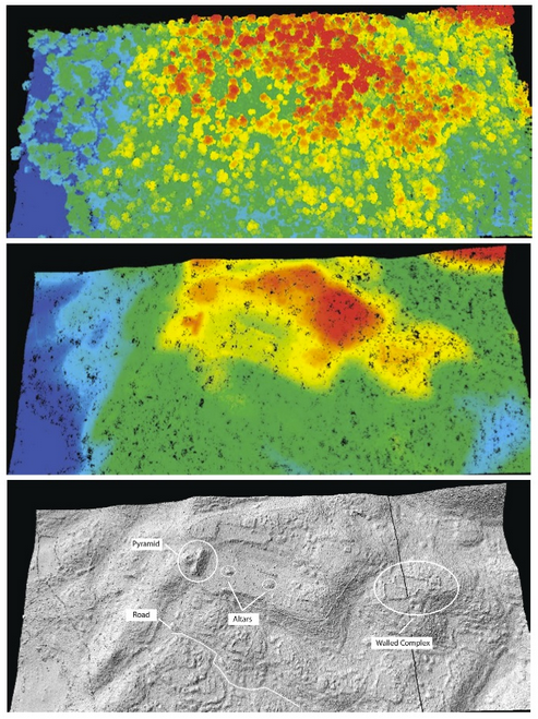
Last year, LiDAR enabled Fisher to create a full-fledged picture of the important Mesoamerican capital in greater detail. This included the discovery of several pyramids, ceremonial complexes and thousands of residences and other buildings that no one knew existed in the city. Much is known about the Purepecha at the time of European contact in the 16th century, but little has been uncovered about their origins. This project should help with that.
"We got LiDAR flown over the ancient city last January and were able to use the data last summer," Fisher said. "We've been able to analyze and manipulate the data quite a bit since then. Wow! What's unique about our use of LiDAR is the density of points and the high accuracy levels. Our data are like the scene in Avatar where they have the three-dimensional table and are planning the assault on the home tree."
Just for the record, Fisher and his students aren't looking to take down the metaphorical tree. Far from it; his Legacies of Resilience project is dedicated to understanding landscape change over time, both for the historical merit of such an investigation and for the practical purposes of understanding our own future. Fisher and his team seek to understand how the environment allowed for the development of a people capable of limiting Aztec expansion.
Pure science is not the only rationale for the use of LiDAR and other technologies. In a tight economic time, academic funds are sparser that usual, so anything that can save money is welcome.
"LiDAR technology (helps) map not only ancient architecture," Fisher wrote, "but the underlying landscape in a more cost-effective manner than would a traditional archaeological survey."
Additionally, the quality of the data is better than any method that has come before.
"LiDAR has been around for a while (since the 80’s), used extensively for archaeology in the UK, and other places in Europe," Fisher said. "But it has only been recently that the resolution is high enough to see individual archaeological features. Each point that we have has a plus/minus range of 2.5cm—roughly the size of a Rubik’s Cube. So we can now use it to investigate not only ancient cities but the broader landscape, and connections between these features on the landscape. For the first time we are able to record the world in the same way that we experience it—in three dimensions. "
A geospatial revolution
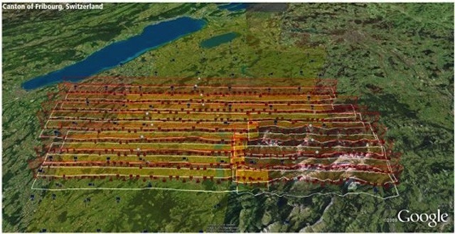
The only other analogous use of LiDAR since the data density has increased was by Arlen and Diana Chase, at Caracol in Belize. In four days of LiDAR over-flights in 2009, the Chases gathered more information than in the previous 25 years of investigations at that site, mapping 80 square miles of the city and its surroundings.
Arlen Chase responded briefly to our inquiries. ("I am currently at Caracol on a BlackBerry barely sending through a Guatemalan cell tower," he wrote.) He agreed with Fisher's description of LiDAR. "LiDAR is a paradigm shift for archaeology," he wrote. In fact, he, Diane Chase, and Fisher have co-authored a yet-to-be-published paper that makes that case: "The Geospatial Revolution in Archaeology: LiDAR, Regional Survey, and the Protection and Modeing of Ancient Societies."
What exactly does this revolution consist of? Speed. Cost. Complexity. LiDAR and its related technology have compressed information gathering in much the same way that computing itself increased the speed of number-crunching. A landscape, with its architectural and agricultural artifacts, can be mapped in extraordinary detail in a fraction of the time it used to take, and for a much-reduced price. This enables archaeologists to model, reason, and theorize, to spend more of their time using the data rather than gathering it.
Additionally, the information gathered is conceivably immune to time, or at least more resistant to decay than much of archaeology's early information.
"The data are indelible," Fisher told Ars, "not like a photograph; [they] do not degrade. They also represent a point cloud rather than a static image. We as archaeologists are in a losing battle to preserve cultural heritage in the face of an ever expanding world. LiDAR freezes the landscape--everything in that landscape; vegetation, animals, etc.--at the moment. Imagine if we had LiDAR images for critical archaeological sites from a hundred years ago. We hope that a hundred years from today researchers will be able to use our LiDAR data to investigate Angamuco in ways that we cannot yet conceive."
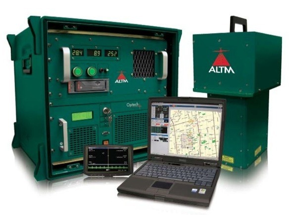
Listing image by Image courtesy of OpTech
reader comments
42