Snow falls in some areas and rain predicted
- Published

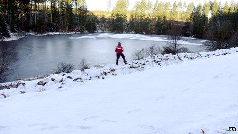
Snow has fallen across parts of northern England and southern Scotland, with more forecast over the weekend.
Up to an inch (25mm) of snow settled in some areas. Temperatures fell early on Saturday to -7C at Shap, in Cumbria.
Meanwhile, two of Scotland's five ski resorts have opened for business this weekend because there is enough snow cover to get the season under way.
The Met Office said recent wet weather, which flooded about 800 UK homes, meant "an increased risk of icy patches".
Light snowfall was reported in Cumbria, Teesside and County Durham, with an inch of snow falling in the Pennines and the Southern Uplands.
Heavy bursts of rain have been forecast for Sunday and Monday in parts of the UK, with up to 20mm (0.75in) expected in flood-hit south-west England.
BBC Weather forecaster Mike Silverstone said: "It could potentially cause more flooding issues there. It's not going to help."
He said a band of rain would move from western England eastwards late on Sunday going into Monday morning.
A band of warm air means temperatures will rise on Monday, but the cold weather will return by Wednesday.
Almost 50 flood warnings are still in place after heavy rain and winds battered parts of Britain earlier in the week.
Three people died in the storms.
And hundreds of households are continuing the clean-up process in the aftermath of flooding, which hit parts of England and Wales.
In Gloucestershire, which was badly hit by flooding, the county council's 33-strong team of gritters are expected to be out throughout the weekend.
With cold weather persisting, BBC Weather said there was a yellow warning of snow for inland areas of Scotland and northern England, which means rain is "likely to turn to snow" in those areas.
The Met Office has issued a low-level warning of severe weather, affecting much of the UK into Sunday morning.
It said: "Due to the recent wet weather there is an increased risk of icy patches, even on roads that have been treated with salt, where water run off/seepage may wash off any earlier salt treatment.
"The public should be aware of the risk of ice on roads and pavements."
The AA has warned drivers to be careful in the cold weather.
Patroller Andy Smith said: "This weekend will be winter's first serious test for drivers and their cars.
Scotland's snow sports areas are hoping for an early season boost
"Ice is the real concern, as it's been so wet recently, and it's very hard to distinguish between a puddle on the road and treacherous black ice."
He warned motorists to reduce their speed, leave adequate travel time for journeys, and to conduct basic checks to ensure the vehicle is in proper working order.
Frosty weather is expected to last for the next few days, with more snow predicted in northern England and Scotland on Sunday night.
The light covering of snow in parts of the UK has already prompted a flurry of bets on a white Christmas, according to bookmakers Ladbrokes.
Meanwhile, the snowsports centres at Cairngorm and the Lecht said there was enough snow cover to get the season under way.
There was around 76mm (3in) of fresh snow at CairnGorm Mountain overnight. Operators have invested in four new snow cannons in order to open their higher runs.
The Cairngorms range has had snowfalls since October.
Sportscotland Avalanche Information Service (SAIS) has reported snow covering summits in the range.
- Published1 December 2012
- Published1 December 2012
- Published29 November 2012
- Published26 November 2012