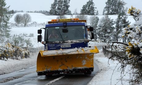
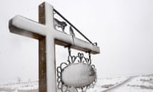
The gale-force winds, snow, sleet and rain that battered parts of Britain and left around 10,000 homes across the north-east of England without power are set to continue on Wednesday.
Some transport routes remain closed after a wintry blast of weather brought Britain's early summer to an abrupt end.
The Met Office has issued severe yellow weather warnings for snow and ice in parts of Scotland, Wales, northern England and the Midlands.
Gale-force winds, which reached nearly 70mph on Tuesday night, have continued in northern areas of England and Wales, according to forecasters.
Northern Powergrid said its engineers had been working throughout the night to restore power to customers after more than 200 faults were reported on Tuesday.
Power cuts began to hit the Northumberland area as overhead cables were blown down by strong winds before areas further south began to be affected. Rain and snow delayed repairs.
Eleven thousand Scottish Hydro customers were left without power on Tuesday morning.
Forecasters said 15-20cm of snow had fallen in high parts of the Peak District, Pennines and Cumbria on Tuesday night, while trees were felled on higher ground as the Arctic front that battered Scotland began to move south.
Cumbria police said the A66 trans-Pennine route remained closed in both directions and advised drivers to use alternative routes. The A537 in Cheshire was badly affected by snow.
Aisling Creevy, a forecaster with MeteoGroup, the weather division of the Press Association, said a slow-moving band of rain, sleet and snow would continue to cause problems on higher ground as it moved south.
"There is currently a band of rain, sleet and snow across northern Wales, the north-west Midlands and northern England, which will generally move southwards throughout the day leaving very cold and icy conditions behind it," she said.
"There will also be very strong winds again today after gusts of 66mph were recorded in Warcop in Cumbria overnight."
Temperatures in London and the south are expected to range between 9C and 12C during Wednesday while reaching 4-7C elsewhere, she said. Temperatures in the north could drop as low as -5C overnight.
The Met Office said: "Rain is expected to turn to snow on high ground as colder air moves south across England and Wales.
"Some 2-5cm of snow is likely in places, mainly above around 200 metres with as much as 10-15cm possible above 300 metres.
"Little, if any, snow is expected to accumulate on roads and pavements below 200 metres. The area of rain, sleet and snow will clear from the north during the day."


